The juvenile life stage is a crucial determinant of forest dynamics and a first indicator of changes to species’ ranges under climate change. However, paucity of detailed re‐measurement data of seedlings, saplings and small trees means that their demography is not well understood at large scales, and rarely represented in forest models in detail. In this study we quantify the effects of climate and density dependence on recruitment and juvenile growth and mortality rates of thirteen species measured in the Spanish Forest Inventory. Single‐census sapling count data is used to constrain demographic parameters of a simple forest juvenile dynamics model based on the perfect plasticity approximation model (PPA) within a likelihood‐free parameterisation method, Approximate Bayesian Computation. Our results highlight marked differences between species, and the important role of climate and stand structure, in controlling juvenile dynamics. Recruitment had a hump‐shaped relationship with conspecific density, and for most species conspecific competition had a stronger negative effect than heterospecific competition. Mediterranean species showed on average higher mortality and lower growth rates than temperate species, and in low density stands recruitment and mortality rates were positively correlated. Under climate change our model predicted declines in recruitment rates for almost all species. Reliable predictive models of forest dynamics should include realistic representation of critical early life‐stage processes and our approach demonstrates that existing coarse count data can be used to parameterise such models. Approximate Bayesian Computation may have wide application in many fields of ecology to unlock information about past processes from single survey observations.
Developing a robust algorithm for automatic individual tree crown (ITC) detection from airborne laser scanning (ALS) data sets is important for tracking the responses of trees to anthropogenic change. Such approaches allow the size, growth, and mortality of individual trees to be measured, enabling forest carbon stocks and dynamics to be tracked and understood. Many algorithms exist for structurally simple forests, including coniferous forests and plantations. Finding a robust solution for structurally complex, species-rich tropical forests remains a challenge; existing segmentation algorithms often perform less well than simple area-based approaches when estimating plot-level biomass. Here, we describe a multiclass graph cut (MCGC) approach to tree crown delineation. This uses local 3D geometry and density information, alongside knowledge of crown allometries, to segment ITCs from airborne light detection and ranging point clouds. Our approach robustly identifies trees in the top and intermediate layers of the canopy, but cannot recognize small trees. From these 3D crowns, we are able to measure individual tree biomass. Comparing these estimates with those from permanent inventory plots, our algorithm can produce robust estimates of hectare-scale carbon density, demonstrating the power of ITC approaches in monitoring forests. The flexibility of our method to add additional dimensions of information, such as spectral reflectance, make this approach an obvious avenue for future development and extension to other sources of 3D data, such as structure from motion data sets.
Forest understorey microclimates are often buffered against extreme heat or cold, with important implications for the organisms living in these environments. We quantified seasonal effects of understorey microclimate predictors describing canopy structure, canopy composition and topography (i.e., local factors) and the forest patch size and distance to the coast (i.e., landscape factors).
The local canopy cover was a strong nonlinear driver of the maximum temperature offset during summer, and we found increased cooling beneath tree species that cast the deepest shade. Seasonal offsets of minimum temperature were mainly regulated by landscape and topographic features, such as the distance to the coast and topographic position.
Forest organisms experience less severe temperature extremes than suggested by currently available macroclimate data; therefore, climate–species relationships and the responses of species to anthropogenic global warming cannot be modelled accurately in forests using macroclimate data alone. Changes in canopy cover and composition will strongly modulate the warming of maximum temperatures in forest understories, with important implications for understanding the responses of forest biodiversity and functioning to the combined threats of land‐use change and climate change. Our predictive models are generally applicable across lowland temperate deciduous forests, providing ecologically important microclimate data for forest understories.
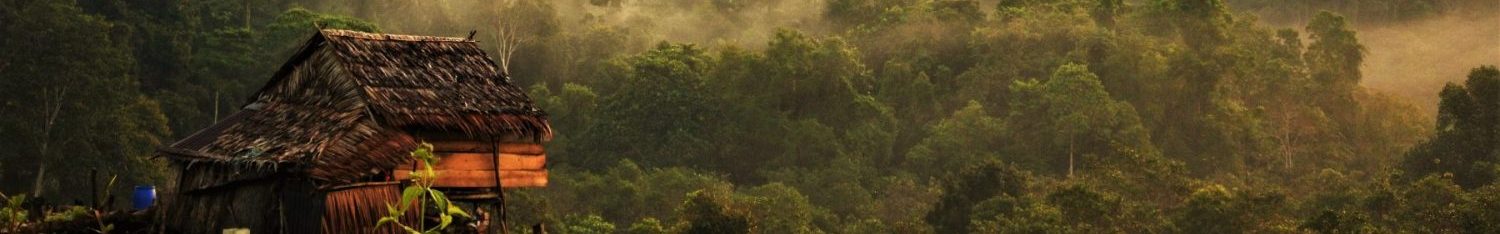
El Niño events generate periods of relatively low precipitation, low cloud cover and high temperature over the rainforests of Southeast Asia, but their impact on tree physiology remains poorly understood. Here we use remote sensing and functional trait approaches – commonly used to understand plant acclimation to environmental fluctuations – to evaluate rainforest responses to an El Niño event at a site in northern Borneo. Spaceborne measurements (i.e. NDVI calculated from MODIS data) show the rainforest canopy greened throughout 2015, coinciding with a strengthening of the El Niño event in Sabah, Malaysia, then lost greenness in early 2016, when the El Niño was at its peak.
Leaf chemical and structural traits measured for mature leaves of 65 species (104 branches from 99 tree canopies), during and after this El Niño event revealed that chlorophyll and carotenoid concentrations were 35% higher in mid 2015 than in mid 2016. Foliar concentrations of the nutrients N, P, K and Mg did not vary, suggesting the mineralisation and transportation processes were unaffected by the El Niño event. Leaves contained more phenolics, tannins and cellulose but less Ca and lignin during the El Niño event, with concentration shifts varying strongly among species.
These changes in functional traits were also apparent in hyperspectral reflectance data collected using a field spectrometer, particularly in the shortwave infrared region. Leaf-level acclimation and leaf turnover could have driven the trait changes observed. We argue that trees were not water limited in the initial phase of the El Niño event, and responded by flushing new leaves, seen in the canopy greening trend and higher pigment concentrations (associated with young leaves); we argue that high evaporative demand and depleted soil water eventually caused leaves to drop in 2016. However, further studies are needed to confirm these ideas. Time-series of vegetation dynamics obtained from space can only be understood if changes in functional traits, as well as the quantity of leaves in canopies, are monitored on the ground.
Tropical forests harbour remarkable density and diversity of woody plants, but how different processes interact to enable so many species to co-exist despite intense competition for resources is yet unresolved.
Traditionally, tropical diversity has been studied by establishing field inventory plots, but this is difficult and labour-intensive task, which limits the area that can be surveyed. In our latest paper, we use remote observation approaches to map how plant diversity changes over an entire landscape where three distinct forest types have previously been identified. We find that the species composition is spatially autocorrelated – nearby forest patches support similar plant communities while distant patches are more different. This spatial autocorrelation in community composition spans over kilometres – much farther than what is recorded from field surveys.
When the three forest types were examined separately, we detected different pattens of spatial autocorrelation in each of them. One process that may explain those different pattens is environmental niche filtering – differences in the topography and soil composition of the soil types may select for different species, creating the patterns we observe. To test if this is the case, we combined the landscape diversity maps with a fine scale reconstruction of the topography of the landscape and found that environmental niches have varying contribution to the diversity of each soil type.
However, differences in the underlying environment were insufficient to explain the high levels of change in diversity from one forest patch to the next. Another process that may structure the pattens we observed is limited seed dispersal: distant patches may be different not because their environments are distinct, but because trees are unable to disperse their seeds far away. We created a set of models that were parametrised to operate around environmental constraints and we found that once the contribution of environmental niches is accounted for, the residual variation in spatial autocorrelation can be reconstructed as dispersal limitation over the entire landscape.
Previous studies have been unable to partition the contribution of environmental niches and limited dispersal as they only looked at the small spatial scales surveyed on the ground. By considering larger spatial scale, we were able to show that niche processes structure tropical diversity over a range of scales while limited dispersal acts locally to enhance species richness in tropical landscapes.
Here we report the recent discovery of the world’s tallest tropical tree (Shorea faguetiana), possibly the world’s tallest angiosperm (flowering plant), located in the rainforests of Sabah, Malaysian Borneo. In addition, we provide a novel three-dimensional exploration of the dimensions of this remarkable tree and use these data to speculate on what drives the limits of tree height. Through consideration of both mechanical (risk of wind damage) and ecophysiological constraints we argue that this tree is close to the maximum height possible for angiosperms, around 100 m, and discuss more broadly what the nature and location of this tree imply about the limits to tree height. We propose to name this remarkable tree “Menara”, Malay for “tower”.
This tall tree (“Menara”) was first identified during an airborne Light Detection and Ranging (LiDAR) survey conducted in 2014. The tree is located in the Danum Valley Conservation Area (DVCA) in Sabah, which also holds the previous record holder for tallest tropical tree . This tree is located at an elevation of 436m a.s.l on a slope of 33◦ and an aspect of 72◦. Because airborne LiDAR is prone to significant errors when used to estimate heights of individual trees (Wan Mohd Jaffar et al 2018), and because hilly topography will likely exacerbate those errors, record claims need to verified by reliable and calibrated instruments (such as Terrestrial Laser Scanning [TLS]) and, ideally, manual tape measurement. Hence, following the airborne identification, researchers returned in August 2018 to manually measure trunk diameter and conduct TLS scans and a drone flight to construct a detailed 3D model (Figure 1) and to calculate tree height and other dimensions . A further visit was conducted in January 2019, during which the tree was climbed to the top of its crown so the height could be directly verified with a measuring tape (Figure 2).
“Menara” is a Shorea faguetiana tree (common name Yellow Meranti), of the Dipterocarpaceae family, a taxon that dominates the humid lowland rainforests of SE Asia. As verified by measuring tape, it has a height of 100.8 m (distance to lowest part of the buttress; distance to lowest part of bole is 98.90 m, distance to highest base point of bole 96.26 m). This tree exceeds previous record holders including another tree in Danum Valley estimated at 94.1m by airborne LiDAR (ALS) in 2016 as well as a media report of a 96.9m Shorea faguetiana recorded in Tawau Hills National Park, Sabah, in May 20181. This makes it unambiguously the tallest tropical tree yet recorded anywhere in the world.
The tree is also potentially the tallest angiosperm (flowering plant). From the lowest point of the buttress, “Menara” exceeds the 99.67 m record of tape-drop measurements of the “Centurion” tree in 2016, a Eucalyptus regnans in Tasmania, Australia . Debates in protocols in how height-to-base is defined (to the lowest above-ground point, or to the median or mean ground-level point), and uncertainty in more recent rangefinder measurements of “Centurion” (Larjavaara and Muller-Landau, 2013) leave some room for ambiguity between these two giant trees, but “Menara” is now clearly a contender for the world’s tallest angiosperm. For comparison, the tallest gymnosperm on record is the “Hyperion”, a coastal redwood (Sequoia sempervirens) in California with a height of 115.7 m (Sillett et al 2010) .
The TLS scan and drone flight enable us to establish additional dimensional information about this tree, and thus examine the mechanics of such giant trees. Using literature values of wood density for this species, we estimate that the tree has an above-ground fresh biomass of 81,500 kg (dry biomass 77,400 kg), of which only 5% is in the crown (which has diameter 40 m) and 95% is in the trunk. The stem is very straight, with the centre of mass at 28 m above the ground and only displaced by 0.6m from the central vertical axis, suggesting this tree is highly symmetrical and well-balanced despite being situated on strongly sloping ground. Menara’s diameter above the buttress is 212 cm (Figure 2b). This conforms with the general and remarkable slender architecture of dipterocarp trees; in stark contrast, the Centurion eucalyptus has a diameter of 405 cm.
3D model of the tree
Tree height may be limited by mechanical, ecophysiological, and hydraulic constraints (Niklas, 2007), and perhaps also by genetic programming (Becker et al, 2000). Is this tree near the likely mechanical limits for angiosperm tree height? By having a spreading crown and therefore a high centre of mass, most simple-crowned angiosperms are likely to have stronger mechanical constraints on their height than gymnosperms with a more tapering architecture (Jaouen et al., 2007). Interestingly, the tall Eucalyptus regnans appears to have a very different, superficially somewhat gymnosperm-like architecture, with a wide trunk diameter and short branches extending throughout much of its length). An analysis based on the three dimensional model of Menara (Jackson et al, submitted) suggests that this tree is a long way from buckling under its own weight (it would need to attain approximately 255 m in height to hit that threshold), but is vulnerable to breakage under moderate wind speeds, and therefore may be close to a wind-related maximum height constraint. The methods employed in this mechanical analysis are excluded here for readability, but are explained in detail in Jackson et al (2019, submitted).
The tree is partially sheltered by a ridge and is in a local topographic low-point, which is likely to have facilitated its growth to record heights. The effect of this ridge as a form of shelter from wind is clear from the differences in average tree heights on either side of the ridge (Figure 3a). Spatial patterns of tree heights across the DVCA in relation to aspect (Figure 3c) and slope (Figure 3d) suggest that the tallest trees (>70m) may only reach such heights on aspects sheltered from the prevailing wind and with a slope steep enough to act as a wind barrier. This distinct spatial patterning of the largest trees in relation to topography suggests that wind stress may be the prevailing constraint on maximum tree height.
Ecophysiological constraints may also play a role. Jensen and Zwieniecki (2013) examined the basic physiological and geometrical constraints of the carbohydrate distribution network (pumping sugars from the leaves to the rest of the tree) and argued that, under ideal conditions (good moisture supply and low wind speed, as found in Sabah), the maximum possible height of angiosperm trees should be 104±6 m. They show from an examination of leaf size data (predominantly from tropical SE Asia) that leaf size becomes increasingly constrained with increasing height, and that above ~100 m height angiosperm leaves cannot maintain sufficient carbohydrate transport speeds in the phloem to maintain tree metabolism. Hydraulic constraints may also play a role: as trees grow taller, large negative pressures due to the weight of the long water columns suspended from crown to soil may ultimately limit leaf expansion and photosynthesis, even with ample soil moisture. From ecophysiological studies of California redwoods, Koch et al. (2004) predicted a maximum gymnosperm tree height of 122-130 m. Angiosperms, with their generally more efficient but less conservative hydraulic networks, are likely to be more constrained than gymnosperms by hydraulic constraints. These hydraulic constraints may drive limits to tree height (Liu et al, 2019), and the valley where this tree is located may ameliorate these hydraulic limits by maintaining humid soils.
Recent studies have shown that tall trees may be especially vulnerable to droughts (Bennett et al., 2015; Shenkin et al., 2018), likely because they are already close to hydraulic limits. Droughts in Borneo are associated with elevated tree mortality rates (Leighton and Wirawan, 1986, Woods, 1989, Nakagawa et al., 2000, van Nieuwstadt and Sheil, 2005), and droughts across the tropics are expected to increase in depth and frequency as climate change proceeds (Malhi et al., 2008). In Borneo, annual precipitation has dropped by over 700mm annually since the 1950s, likely due to land use change (McAlpine et al., 2018). Tall trees such as this Shorea faguetiana, which tend to have more cavitation-prone xylem (Liu et al, 2019), may therefore be vulnerable to these changing drought regimes. Perhaps due to its position near a valley bottom, “Menara” may be somewhat insured against droughts; indeed, its crown and foliage appear full and healthy. Thus, valleys may create multiple abiotic conditions that allow trees to grow taller than they would be able to otherwise.
Are there likely to be taller trees out there? The recent spate of records derived from airborne LiDAR surveys1 suggests that taller tropical trees may yet be found: we predict that they are almost certainly in northern Borneo, will be of the genus Shorea and probably the species Shorea faguetiania, and they will be found in similarly sheltered locations in the local topography. Given the evidence of mechanical (wind) and ecophysiological constraints as outlined above, it is unlikely that any new tree would be much taller, but probably tall enough to unambiguously break the record for tallest angiosperm. Hence it is likely that the world’s tallest extant flowering plant still sits undiscovered somewhere in the forests of Borneo.
This work highlights that in the world’s tropical rainforests some of the largest organisms on Earth still await discovery and description. Over the past decade the Sabah Forestry Department has progressively extended the protection of several hundred thousand hectares of forest in the vicinity of the Danum Valley Conservation Area – which is now buffered on all sides by totally protected areas (Reynolds et al., 2011). Further, the Sabah Government has committed, by 2025, to increase the extent of protected forests to 30% of the State’s land area (Sabah Forestry Department, 2018). The discovery of this remarkable tree provides additional recognition to, and impetus for, efforts to conserve these magnificent, biodiverse and record-breaking tall rainforests.
Along with our colleagues from UCL and Wageningen University, we mapped the range of tree architecture using terrestrial laser scanning data. This was done by scanning trees and forests from multiple locations, fitting cylinders to the raw point cloud data and then extracting architectural metrics from those cylinder models. Overall, the results were pretty intuitive: trees from tropical forests span a wider range of architectures than those from temperate forests or open-grown, tree size was the primary axis of variation and the second axis was driven by crown shape
More interestingly, open-grown trees tended to cluster around high path fraction, which can be interpreted as a measure of hydraulic efficiency. Path fraction is defined as the ratio of the mean to maximum trunk-to-twig path length. Ideal fractal trees, the most hydraulically efficient architecture, will have a path fraction of 1, while real trees will always be below 1. The hydraulically efficient architecture evident in the open-grown trees may be due to the absence of competition for light, allowing them to grow into a more optimal shape.
This analysis was part of a recent article exploring the natural sway frequencies of trees. We found that, while conifers behave like simple beams, broadleaf tree architecture plays an important role in determining their response to wind loading.
If you’d like to see more 3D models of trees check out this and this. If you are interested in extracting tree architectural indices from terrestrial laser scanning data have a look at the TreeQSM and treestruct github pages.
Most studies exploring
habitat fragmentation effect on biodiversity were conducted at the local or
regional level. These studies generally ignored background information (e.g.
history, drivers and dynamics) of forest fragmentation which is critical for biodiversity
conservation at large scales (e.g. national scale). Hence, these studies
provided little practical implications for forest management in fragmented
landscapes. Thanks to the rapid development of remote sensing technology,
forest fragmentation maps are increasingly available to biodiversity studies.
Using forest in China
as a case study, we found that forest gains under China’s green policies have
not entirely stopped fragmentation of natural forests. Road constructions and
urbanisation are becoming the most influential drivers of forest fragmentation
in recent decades. Currently, most fragmentation studies focus on old-growth
forests, while the dominant forest type, secondary forest fragments, have
received little attention. Most of forest fragments in China are small,
isolated and in resources-poor regions, in other words, that are not optimal
habitats for resident species. Large, long‐term projects which
monitor spatiotemporal changes in forest cover and biodiversity are needed to
address the question related to long term effects of forest fragmentation.
Forest fragmentation is still common in regions with forest gains
Our research suggests that government policy should not only focus on forest cover, it is vital to increase forest quality to maintain biodiversity.
This project was completed while Jiajia Liu was a visiting postdoctoral researcher in Coomes lab, and David invested a huge amount of time and efforts on this project.
We have quantified the temperature difference between sites within forests and outside, for the first time across the globe. Measurements occurred at 98 locations spread across five continents, in the tropics, temperate zone and northern boreal forests. The data show that the maximum temperature in forests is, on average across the globe, 4 degrees lower than outside forests.
Forests as thermal insulation
With their foliage and branches in the canopy, trees create a thermal isolating layer above the forest, cooling the understory when ambient temperatures are hot and warming the understory when ambient temperatures are cold. Summer heat waves are thus strongly moderated below the tree canopy. Plants and animals inside forests will thus experience the current warming trend to a lower degree than species not living in forests. Since forests cover a quarter of the land surface of the globe and harbour two thirds of all biodiversity, this has important implications for predictions on the impact of climate change.
Buffer against climate warming
We also show that with increasing temperatures, the buffering capacity of maximum temperatures of global forests also increases. The warming of maximum air temperatures within forests is thus probably lower than previously anticipated. Forests can therefore truly be considered a buffer against climate warming. Accordingly, our findings stress the need to conserve the existing forests and enhance reforestation efforts.
Traditional studies
generally consider habitat fragmentation as a driver of downsizing of plant
seeds due to the disappearance of large seed dispersing vertebrates. However,
most of these studies focuses on old‐growth forests, and much less
is known about influences of habitat fragmentation on seed size pattern in
patches of regenerating forests. This pattern may differ for secondary forest
fragments where differential migration ability rather than persistence of seed
dispersers may be driving plant community assembly.
To answer this
question, we collected species distribution data of plants, birds, large and
small mammals on islands in the Thousand Island Lake, China. We found that both
richness and abundance of birds are determined by island size, but not for
mammals. Such differential responses of potential seed dispersers led to a
higher proportion of seed dispersal of bird-dispersed plants on large islands.
Given that birds generally disperse smaller seeds than mammals, large islands
may accumulate more small-seeded plants.
Structural equation model showing the main drivers of community level seed size patterns on islands in Thousand Island Lake
This is extremely useful to guide effective
forest restoration given that many forests worldwide are empty forests without
large mammals. Our study highlights the importance of keeping large continuous
forests in order to retain mammals and their dispersal capabilities.